EatingOnions@lemmy.world to World News@lemmy.worldEnglish · 2 months agoPokémon Go data ‘exploited to develop navigation’ for military dronestvpworld.comexternal-linkmessage-square25linkfedilinkarrow-up11arrow-down10
arrow-up11arrow-down1external-linkPokémon Go data ‘exploited to develop navigation’ for military dronestvpworld.comEatingOnions@lemmy.world to World News@lemmy.worldEnglish · 2 months agomessage-square25linkfedilink
minus-square🇨🇦 tunetardis@piefed.calinkfedilinkEnglisharrow-up0·2 months agoThe article suggests visual scans—presumably of Pokéstops and what not—could be used in drone navigation when GPS is jammed. Wouldn’t Street View be far more appropriate for that?
minus-squarefrongt@lemmy.ziplinkfedilinkEnglisharrow-up0·2 months agoIt gets outdated pretty quickly, and only covers where they can drive. Not to mention, if you can crowdsource it, you don’t have to do it at all.
minus-squarecomrade_twisty@feddit.orglinkfedilinkEnglisharrow-up0·2 months agoPlaygrounds and hospital atriums are generally not mapped well on street view.
minus-squarekungen@feddit.nulinkfedilinkEnglisharrow-up0·2 months agoScans include more information than just pictures, as it’s tied with metrics of azimuth/yaw/pitch/roll/etc.


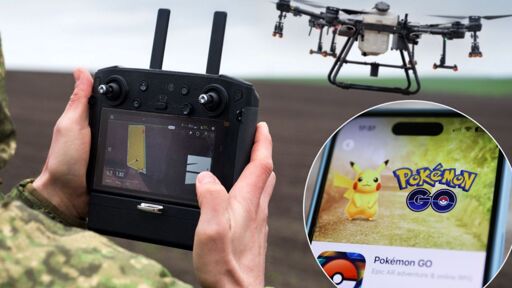
The article suggests visual scans—presumably of Pokéstops and what not—could be used in drone navigation when GPS is jammed. Wouldn’t Street View be far more appropriate for that?
It gets outdated pretty quickly, and only covers where they can drive. Not to mention, if you can crowdsource it, you don’t have to do it at all.
Playgrounds and hospital atriums are generally not mapped well on street view.
Scans include more information than just pictures, as it’s tied with metrics of azimuth/yaw/pitch/roll/etc.